Viz student developing app to assist emergency responders

Danielle Crowley
An application for mobile devices that will help emergency responders identify key structures in a video feed from a remote-controlled drone is being developed by Danielle Crowley, an undergraduate visualization student at Texas A&M.
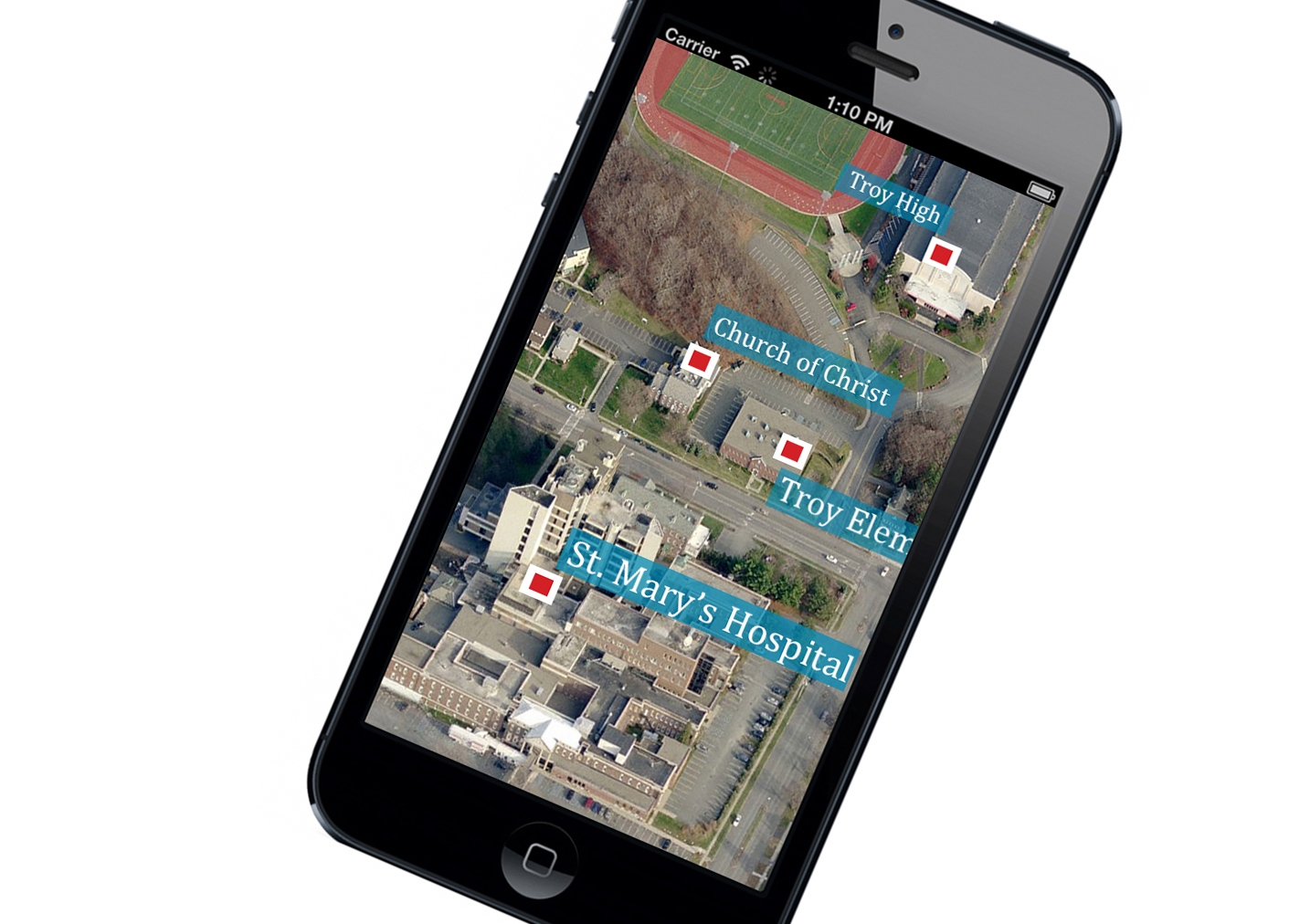
Her application, AerialAR, will label buildings in real-time video from a drone’s camera to help responders grasp the impact of a disaster on its immediate environment and determine what actions to take.
Because camera-carrying drones can enter unreachable or hazardous areas in an emergency and are much cheaper and safer to operate than helicopters, rescue units are expected add them to their emergency response tool kit once regulatory issues are settled.
Early research revealed that responders using remote video have difficulty determining key buildings, said Crowley in a paper detailing her application. The paper was chosen by a jury for a publication associated with the April 26 – May 1 Toronto convention of the Association for Computing Machinery Special Interest Group on Human-Computer Interactions.
Emergency responders, said Crowley, have difficulty immediately determining whether drone-captured video is showing residences, daycare facilities, barns or residences.
Researchers, she said, have also found that emergency workers attempting to identify buildings waste time and increase the possibility of making errors while looking back and forth at video streaming from a drone and a separate display of the scene from Google map, where the some building are identified.
Labeling buildings in live drone video feed poses more challenges for an application than typical annotations like those found in augmented reality browsers on smartphones, she said, because a drone’s images are rendered over a wide range of angles.
Crowley is overcoming this issue by developing a set of equations that translate a drone’s telemetry and field of view onto a Google map, where AerialAR can locate and label mission-relevant buildings such as schools, homes or businesses for quick identification..
She is developing the app with faculty advisers Tim McLaughlin, head of the Department of Visualization, Ann McNamara, assistant professor of visualization, and Robin Murphy, Raytheon Professor of Computer Science and Engineering.
Tags
Related Posts

Posters, addresses earn students 2017 research week honors

Arts council honors Viz prof for hybrid creations

TAMU researchers refine iPad software to aid sight impaired

Projections enliven Bryan facades Nov. 2
Follow Us
Facebook Twitter Vimeo Youtube Flickr RSS
Recent Posts

Planning prof heads study of disaster housing aid

A message from the dean

Former student remembered as expert planner

Leading educator named new head of Architecture Dept.


_thumbnail_small.png)
