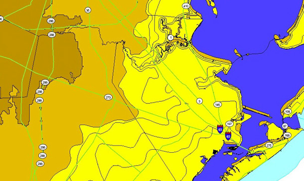
an image of the Texas coast from the coastal city atlas
Galveston newspaper columnist touts Coastal Planning Atlas

Sam Brody
A Galveston Daily News columnist said an interactive, online atlas created from a database compiled by a research team at Texas A&M’s Hazard Reduction and Recovery Center, has greatly increased the odds of reducing the risks of living in the island city.
“It might be a good idea to have those one in every four Texans who live along the coast assigned the atlas as outside reading,” wrote Tom Linton, a member of the Friends of Galveston Island State Park and the Texas Outdoor Writers Association, in the News’ March 14, 2011 issue.
The Coastal Communities Planning Atlas provides images of possible futures of coastal areas in Texas.
Users of the public site can drop one or many of the atlas’ information layers two counties deep all along the Texas coast or pinpoint a spot by zooming in to a specific location. The HRRC gathered data sets such as hurricane storm surge zones, property values, elevation, dams, wetland permits and many more.
“We’ve got interdisciplinary sets of data for all these different layers, and It lets you look at multiple layers of information at the same time and interact with it,” said Brody, an urban planning professor with a joint appointment to the Department of Landscape Architecture and Urban Planning at Texas A&M and Texas A&M University-Galveston’s Department of Marine Sciences, where he serves at the George P. Mitchell Chair in Sustainable Coasts. He’s also head of the HRRC’s Environmental Planning & Sustainability Research Unit and director of the island campus’ Center for Texas Beaches and Shores.
For more about the atlas, visit [archone.tamu.edu] (http://archone.tamu.edu/college/news/newsletters/spring2008/stories/HRRCweb.html) .
The atlas is accessible at [coastalatlas.tamug.edu] (http://coastalatlas.tamug.edu/atlas.htm) .
Linton’s column is available at [galvestondailynews.com] (http://galvestondailynews.com/story/217838/) .
Next Post
Tags
Related Posts

A&M researchers collaborate in U.S. resilience center
Nation's safety enhanced by resiliency studies

Oct. 23 symposium spotlighted college, faculty research

Mapping at-risk populations aids hazard mitigation

Oct. 29 symposium spotlights college, faculty research
Follow Us
Facebook Twitter Vimeo Youtube Flickr RSS
Recent Posts


Planning prof heads study of disaster housing aid

A message from the dean


_thumbnail_small.png)

Former student remembered as expert planner


Leading educator named new head of Architecture Dept.
